Canal du Midi
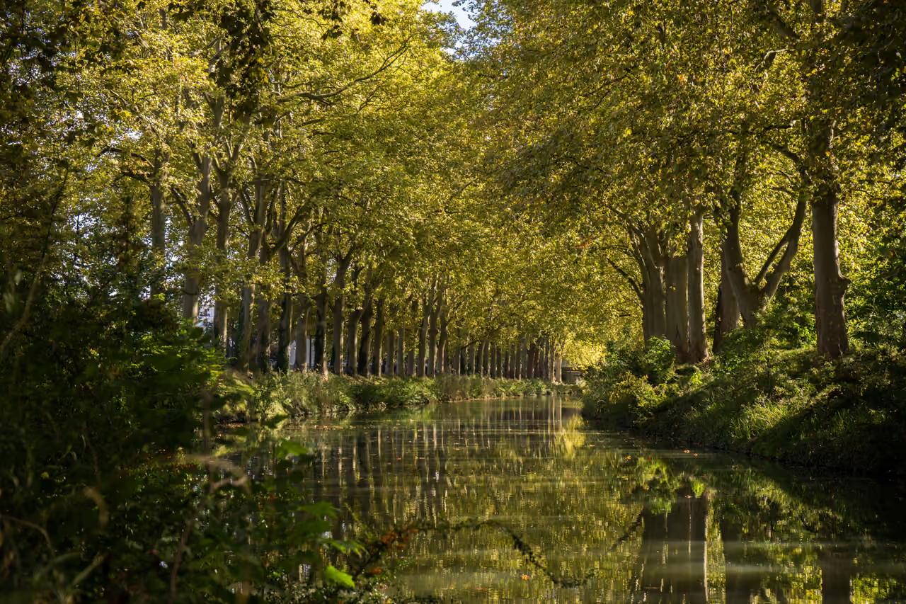
Plane trees lean over the water, the towpath runs flat and shaded, and the surface barely seems to move. In Toulouse the canal slips past brick quays and under humpbacked bridges, then heads south-east through the wheat and sunflower country of the Lauragais towards the Étang de Thau. Hire boats nose into locks where grain barges once queued, and cyclists, rowers and lunchtime joggers share the banks. Every lock has its own curved stone walls, every village has its own mooring, and a few kilometres of walking on any stretch is enough to make the whole idea feel real. The sound that stays with you is a lock chamber draining beside a plane tree, with the lock-keeper's paddle clanking round in the sun.
Videos
History of Canal du Midi
In November 1662 a salt tax collector sat down to write to the king's finance minister about something he admitted he had no business discussing. Pierre-Paul Riquet confessed that he knew neither Greek nor Latin and could barely speak French without stammering, yet he believed a canal could link the Atlantic and the Mediterranean across Languedoc. It was an old dream. Kings from Charlemagne to Henri IV had toyed with it, and earlier engineers had put forward plans in 1539, 1598 and 1617. All of them collapsed on the same problem: where would the water come from to feed a canal climbing over the high ground at Naurouze? Riquet's answer came from years of tramping the Montagne Noire. He had bought the estate of Bonrepos and the water rights of nearby Revel, and with the local fountain-keeper Pierre Campmas he followed streams across the hills until the idea took shape. Rain falling on the mountain could be gathered in a reservoir and sent down channels to the summit of the canal, where it could feed both slopes at once. In 1664 the Estates of Languedoc asked for proof, so he dug a trial channel, the rigole de la plaine, and sent Sor river water all the way to Naurouze in 1665. The sceptics went quiet. Louis XIV signed the edict authorising the work in October 1666. Riquet received the canal as a tax-free hereditary estate, which let the Crown avoid the headache of managing it. The finances were another matter. The budget was around six million livres, and the final bill came to between seventeen and eighteen million. Riquet put in a fifth from his own pocket, and he had to borrow heavily to keep the work going. The first stones of the great reservoir of Saint-Ferréol were laid in April 1667, and the first boats began moving between Toulouse and Naurouze in the winter of 1671 to 1672. Riquet did not live to see the end. He died in October 1680, a few months before the canal was ready. On 15 May 1681 a flotilla set out from Toulouse behind an admiral's barge, with the archbishop of Narbonne among the passengers. It blessed the works at Castelnaudary, passed through the tunnel of Malpas and down the staircase of locks at Fonseranes, and reached Sète on Pentecost Sunday, 25 May. The work was not quite finished, and the canal had to be drained again for finishing touches, but the link between two seas existed. The early years were rough. Streams that Riquet had let flow straight into the canal brought sand and silt in every storm, and the reservoir supply did not deliver enough water. In 1686 Vauban inspected the canal and ordered a programme of repairs that ran into the 1690s. It included a tunnel at the Cammazes to bring more mountain water to Saint-Ferréol, a stronger dam, and masonry aqueducts and bridge-canals to carry the unruly rivers over or around the canal. The following century added the Jonction canal to Narbonne, the Brienne canal in Toulouse, and, in 1810, a diversion that brought the canal through Carcassonne. The Canal latéral à la Garonne completed the route to Bordeaux in 1857. The canal made fortunes for the Riquet family and carried wheat, wine and passengers at a rate that astonished their contemporaries. Its peak came in 1856. Then the railway arrived. The company that leased the canal also ran the Bordeaux to Sète line and raised canal tolls, and within a generation goods traffic had roughly halved. The State bought the canal back in 1898 and dropped tolls, and motor barges kept some trade alive well into the twentieth century. The last regular cargo boats stopped in 1989, when a drought halted navigation. By then people had started to see the canal differently. In 1973 Toulouse's mayor, Pierre Baudis, declined to fill in the city stretch for an urban expressway. British boaters had been discovering the waterway since the 1960s, and the 1980s saw leisure traffic surge. UNESCO inscribed the canal and its water supply system in 1996. Today a new chapter is being written along the banks: a fungal disease has been killing the plane trees since 2006, and tens of thousands of them are being replaced with a mix of other species, giving the towpath a shade pattern that will take decades to settle.
20 events spanning 359 years
Fun Facts
- • Angry landowners complained that they could not hire workers, so Riquet cut the daily rate to 15 sols and then to 12. He later switched to monthly pay to keep his teams loyal.
- • At Fonseranes near Béziers, a staircase of eight lock chambers lifts boats up the slope from the Orb valley. An experimental water slope, built later to speed up boats, now stands out of service next to it.
- • Before the canal was built, Riquet made a working model of it at his estate of Bonrepos, complete with locks, tunnels and overflow weirs. He fed it with real water at the right slopes to test whether the idea would function.
- • In 1858 the canal was leased to the railway company that also ran the Bordeaux to Sète line. Goods traffic on the canal roughly halved between 1856 and 1879.
- • In the mid 1850s, fast passenger boats cut the Toulouse to Sète journey to 32 hours, down from four days, by changing horses every 10 kilometres and transferring passengers between boats rather than waiting at locks.
- • Riquet refused to use forced peasant labour. At its peak the site employed about 12,000 people, around a third of them women, on individual contracts, and pay started at 20 sols a day, roughly double a farm worker's wage. Wet days and sick leave were paid, which was almost unheard of at the time.
- • The Malpas tunnel, about 165 metres long, cuts through a hillside near the Ensérune hilltop settlement and was a major technical gamble for its time.
- • The Pont-canal du Répudre, built between 1667 and 1676 near Paraza, is the oldest bridge-canal on the route and was the first built by Riquet. It carries the canal over a small river that can swell dramatically in winter.
- • The Saint-Ferréol reservoir was a first of its kind. No lake-reservoir of that scale had been built before, and its dam is still in use.
- • The canal's budget was six million livres, but it finally cost between seventeen and eighteen million. The king paid about 40 per cent, the province of Languedoc another 40 per cent, and Riquet himself around 20 per cent, with a loan of 500,000 livres from the financier Pennautier to keep the work going at the end.
- • The canal's characteristic plane trees were mostly planted after the Napoleonic period. Before then, willows, mulberries for silkworms and poplars lined the banks, and today around 42,000 plane trees stand along the route.
- • The round lock at Agde has three gates, so that boats can enter the canal or the River Hérault, and the canal is protected from floods.
- • Thomas Jefferson visited the canal in 1787 and studied it with an eye to American waterways, and the economist Adam Smith, who lived in Toulouse in 1764, is said to have examined how it was run.
RESOURCES
Heritage UNESCO SiteCanal du Midi FAQ
While we strive to keep this information accurate and up to date, we recommend verifying any details independently before making decisions based on them.
Canal du Midi Map & Neighborhood Explorer
This interactive map is centered on Canal du Midi. Zoom in and move the map around to automatically discover Wikipedia photos and summaries of other nearby sights, monuments, and historical points of interest and stories in real-time!
Places near Canal du Midi
Make the most of your trip. Check out these top-rated spots located nearby.
 4960m
4960mTrivalle Street
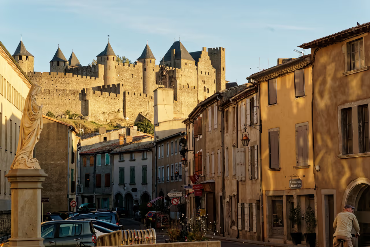
This narrow, sloping lane acts as the primary pedestrian funnel connecting the old bridge to the base of the fortress. Historic townhouses lean slightly over the pavement, throwing deep shadows across the small tapas bars and independent wine shops occupying the ground floors. The energy here is kinetic and loud, as crowds constantly move up and down the incline. It bridges the gap between the two vastly different halves of the city.
highlight view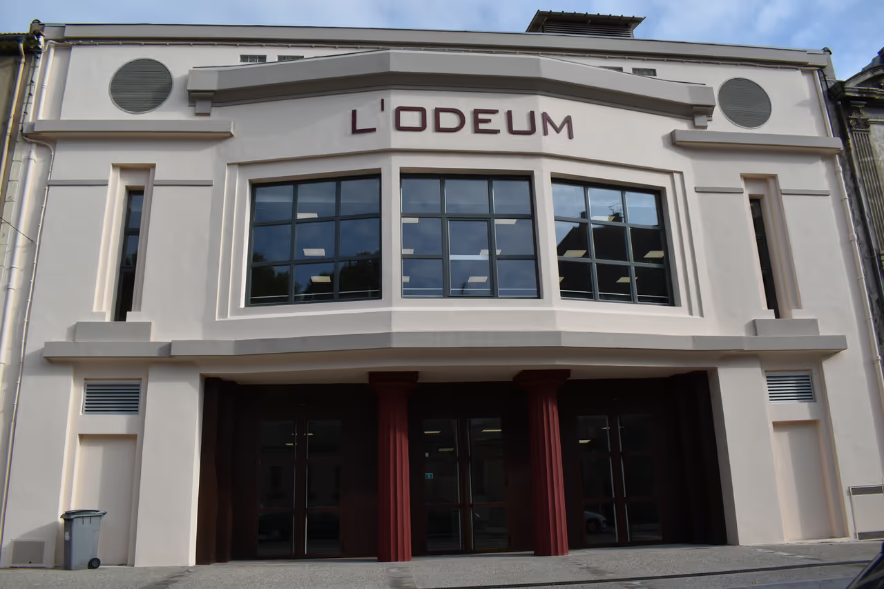 5086m
5086mOdeum Cinema
A sharp, unexpected injection of 20th-century design into the heart of the lower town. The facade features clean, geometric lines and stylised typography characteristic of the 1920s. While it no longer operates as a commercial cinema, the exterior remains a stark contrast to the surrounding heavy 18th-century stone. It looks like a spaceship landed in a medieval province.
architecture view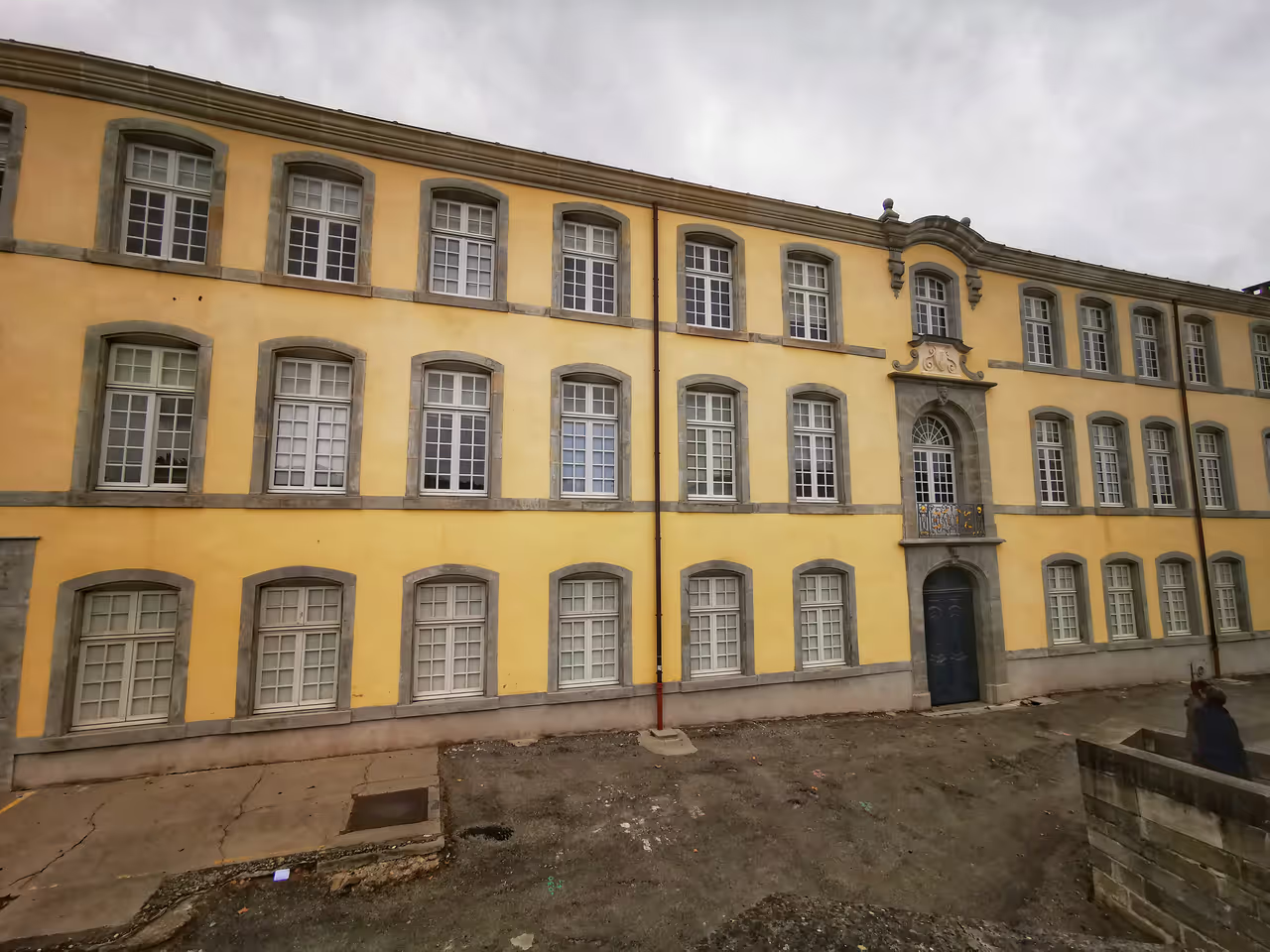 5123m
5123mRoyal Manufacture of Trivalle
A heavy, industrial stone complex sitting quietly at the foot of the old bridge. It once drove the city's immense textile wealth, producing high-grade broadcloth for export. The facade was meticulously restored in 2013, highlighting the severe, practical architecture required for a massive 17th-century factory. Today it functions as an administrative centre, completely hiding its loud, dirty industrial past.
hidden gem view- 5140m
Museum of the Inquisition
A small, heavily atmospheric exhibition detailing the gruesome methods used to extract confessions during the suppression of the Cathars. Iron chairs, stretching racks, and heavy metal masks sit under harsh spotlights in tight, stone-walled rooms. The displays refuse to romanticise the period, focusing instead on the cold mechanics of religious persecution. It is genuinely unsettling and deeply memorable.
highlight view
Explore Similar Places in These Collections
See all unesco sites in Carcassonne
Including Cité de Carcassonne