Hidden Gems & Local Secrets in Hobart

Step off the tourist trail and experience the authentic side of the city. We've bypassed the crowded landmarks to uncover the best-kept local secrets—from quiet neighborhood courtyards to underground art scenes. Dive into the forgotten histories and unique stories that make these spots truly special.

  • Mawson's Huts Replica Museum

    45 M

    Positioned right on the waterfront, this is a meticulous, full scale reconstruction of the wooden basecamp used by legendary Antarctic explorers. Stepping inside immediately immerses you in the claustrophobic, freezing conditions the men endured for years. The soundscape of howling blizzards and the incredibly detailed historic props make the experience highly visceral. It brilliantly connects the city to its ongoing role as a vital polar gateway. It is a deeply moving tribute to one of the greatest survival stories in human history.

    HISTORY & HIGHLIGHTS

    In 1911, the ambitious Australasian Antarctic Expedition, led by Douglas Mawson, departed from these very docks into the completely uncharted southern ice. They constructed a small, incredibly sturdy wooden hut at Cape Denison, which famously became known as the windiest place on the surface of the earth. From this tiny shelter, Mawson undertook a horrific sledging journey where both of his companions perished, forcing him to survive a month long solo trek across the ice. Because the original huts remain incredibly difficult to access in Antarctica, dedicated heritage carpenters built this exact replica on the city waterfront. It was constructed using identical techniques and Baltic pine to allow the public to tangibly connect with this monumental feat of Australian exploration.
    Events spanning 102 years

    YEAR 1911

    Sailing South

    Douglas Mawson departs the city docks to establish a scientific base in the completely unexplored Antarctic territory.

    YEAR 2013

    Bringing the Ice Home

    The highly detailed replica museum officially opens on the waterfront, allowing locals to experience the harsh reality of the historic expedition.

    LOCATION

    Loading map...
  • Allport Library and Museum of Fine Arts

    1 H

    Tucked away inside the modern State Library building is an extraordinary, intimate collection of colonial art and antique furniture. The museum accurately recreates the opulent living quarters of a wealthy nineteenth century local family. It features stunning silver, delicate ceramics, and incredibly rare early colonial paintings. It offers a sharp contrast to the harsh convict stories usually associated with the city's past. The space is remarkably quiet, providing a highly refined and peaceful escape from the busy city streets.

    HISTORY & HIGHLIGHTS

    The Allport family arrived in the colony in 1831, bringing with them wealth, education, and an intense appreciation for the fine arts. Over several generations, they amassed an astonishing collection of rare books, antique furniture, and early colonial artworks. They documented the rapidly changing landscapes and high society life of the isolated island through their own paintings and acquisitions. When the final descendant passed away, the entire priceless collection was generously bequeathed to the people of the state. The museum was meticulously designed to feel like a private home rather than a sterile gallery, preserving the intimate, cultured atmosphere of a bygone aristocratic era.

    Events spanning 134 years

    YEAR 1831

    A Wealthy Arrival

    The prominent Allport family arrives in the colony, bringing an influx of wealth and artistic culture to the rugged settlement.

    YEAR 1965

    A Generous Legacy

    The extensive private collection is officially opened to the public following a generous bequest by the last surviving family member.

    LOCATION

    Loading map...

    FULL PLACE DETAILS

    WEB & AMENITIES

  • Taroona Shot Tower

    SHOT TOWER
    45 M

    This highly unusual historic structure is a massive, circular sandstone tower built specifically for manufacturing lead musket balls. It holds the title of being the tallest shot tower in the Southern Hemisphere. You can climb the meticulously crafted wooden staircase winding up the interior walls to reach the top. The effort is rewarded with phenomenal, commanding views of the wide estuary. The sheer architectural oddity of a giant stone chimney standing on the coastline is fascinating.

    HISTORY & HIGHLIGHTS

    In 1870, an enterprising Scottish immigrant named Joseph Moir decided the colony needed its own reliable supply of lead shot for hunting and defence. Using incredibly precise masonry skills, he constructed this towering structure completely by hand. The process of making shot involved dropping molten lead from the very top of the tower, allowing it to form perfect spheres as it fell before cooling in a pool of water at the base. Moir fiercely protected his manufacturing secrets, and his business thrived for several decades. Today, the tower stands as a brilliant monument to colonial industrial ingenuity. It remains one of the most structurally impressive and peculiar buildings in the entire state.

    Events spanning 80 years

    YEAR 1870

    A Towering Ambition

    Joseph Moir completes the massive sandstone structure to begin manufacturing lead shot for the colony.

    YEAR 1950

    Heritage Protection

    The site is officially recognised and protected for its highly unique industrial architecture and historical significance.

    LOCATION

    Loading map...

    FULL PLACE DETAILS

    ARCHITECTURE & HERITAGE

    Heritage Status
    Listed On The Tasmanian Heritage Register
    Architects
    Joseph Moir
  • Waterworks Reserve

    1 H 30 M

    Hidden just a short drive from the city centre, this tranquil valley feels completely removed from the urban environment. It features beautiful historic sandstone reservoirs that perfectly mirror the surrounding forested hills. Locals absolutely love coming here for weekend barbecues on the sprawling, immaculately kept lawns. You can easily spend an afternoon walking the gentle trails that trace the water edge while spotting native birdlife. Keep a close eye out for pademelons foraging near the tree line as the afternoon shadows lengthen. It is a wonderfully peaceful retreat that showcases the natural beauty and clever pioneer engineering of the region.

    HISTORY & HIGHLIGHTS

    During the mid nineteenth century, the rapidly expanding colony of Hobart Town faced a severe crisis regarding its drinking water. The original Hobart Rivulet had become heavily polluted, leading to widespread disease and desperate pleas for a cleaner, more reliable source. To solve this dire issue, engineers looked toward the pristine catchment areas located high up in the forested foothills of the mountain. In the 1860s, construction began on a massive infrastructure project to capture and store the pure mountain runoff. Labourers carved out deep basins and constructed elegant sandstone receiving houses and retaining walls that still stand today. The incredible craftsmanship turned a purely utilitarian water supply system into a striking architectural achievement nestled perfectly within a lush natural valley. While the city now relies on much larger, modern dams for its primary water supply, these historic reservoirs were brilliantly preserved as a public recreation area. The site transitioned from a critical survival asset into one of the most beloved and peaceful green spaces in the entire district. It remains a fantastic, living monument to the ingenuity and sheer physical effort of the early pioneer engineers.

    Events spanning 73 years

    YEAR 1867

    Securing the Supply

    The Hobart Town Council officially completes the lower reservoir to provide a desperately needed clean water supply for the colony.

    YEAR 1888

    Expanding the Basins

    The upper reservoir is successfully constructed and flooded to meet the soaring demands of the rapidly growing population.

    YEAR 1940

    A Public Sanctuary

    As modern dams take over the primary water supply duties, the historic site is beautifully preserved and transitions into a public recreational reserve.

    LOCATION

    Loading map...

    FULL PLACE DETAILS

    OVERVIEW & STATS

    Established
    In 1897, making it 129 years old
    Elevation
    167 m
  • Nanny Goat Lane

    15 M

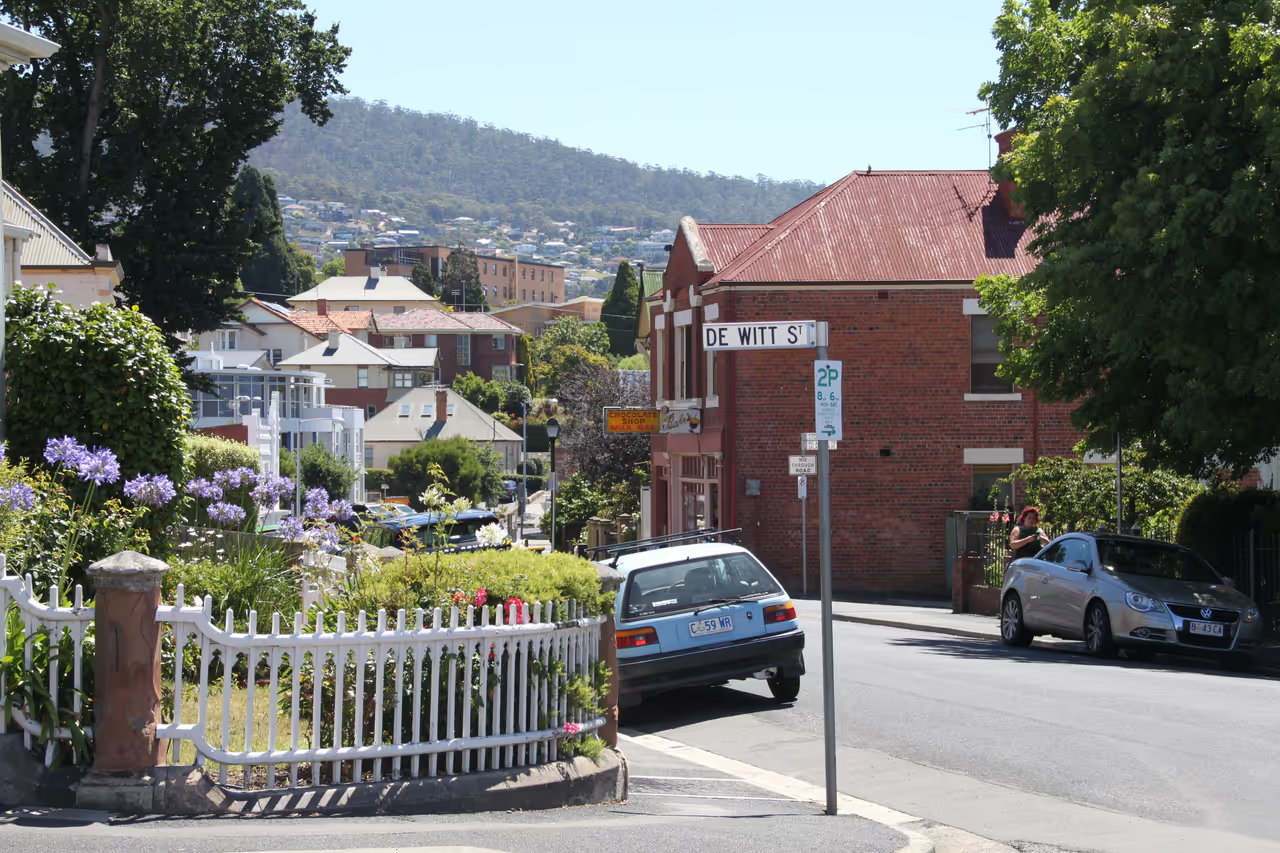
    A wonderfully quirky and incredibly steep pedestrian laneway hidden within the historic streets of Battery Point. Climbing to the top rewards you with superb, unexpected views over the old rooftops toward the river. Finding the whimsical street sign is a fun little scavenger hunt for keen walkers exploring the area. It feels like a secret passageway completely ignored by standard tourist maps. The sheer incline provides a very quick, sharp workout.

    HISTORY & HIGHLIGHTS

    During the nineteenth century, Battery Point was a working class neighbourhood populated by sailors, shipwrights, and labourers. Because the terrain was so incredibly steep and rocky, formal roads were difficult to establish in certain areas, leading to the creation of narrow goat tracks. Locals literally kept goats to help clear the stubborn brush and provide milk, which is how this peculiar path earned its enduring name. As the suburb gentrified over the decades, transitioning from a gritty maritime village to one of the most expensive real estate markets in the state, these small historic quirks were thankfully preserved. The lane serves as a tangible reminder of the area's rough, practical origins before it became a polished tourist destination.

    Events spanning 140 years

    YEAR 1830

    A Working Class Suburb

    The area develops as a rough and ready residential zone for the maritime workers servicing the booming whaling industry.

    YEAR 1970

    Preservation Battles

    Fierce local protests and green bans prevent the demolition of the historic Battery Point streetscapes, saving quirky paths like this one.

    LOCATION

    Loading map...
KEEP EXPLORING

More to see in Hobart